
The aurora could be blazing at KP 7 tonight and you'd never know if it's cloudy. Cloud cover is the most overlooked obstacle for aurora chasers — and the most important one to understand.
Let's be direct: clouds are the number one reason aurora trips fail. Not low KP. Not bad timing. Not choosing the wrong destination. Cloud cover. The aurora can be producing G4 storm-level activity, filling the sky at magnetic latitudes from the equator to the pole, and if you're standing under 8/8 overcast, you'll see absolutely nothing. The space weather is irrelevant. All that energy, all that light — completely invisible.
And yet most aurora-focused content talks almost exclusively about the KP index. Cloud cover gets a brief mention, a "check the weather forecast" note, and then the article moves on. This is exactly backwards from what matters in practice. Understanding cloud forecasts for aurora should get ten times more attention than it does.
Can You See Northern Lights Through Clouds?
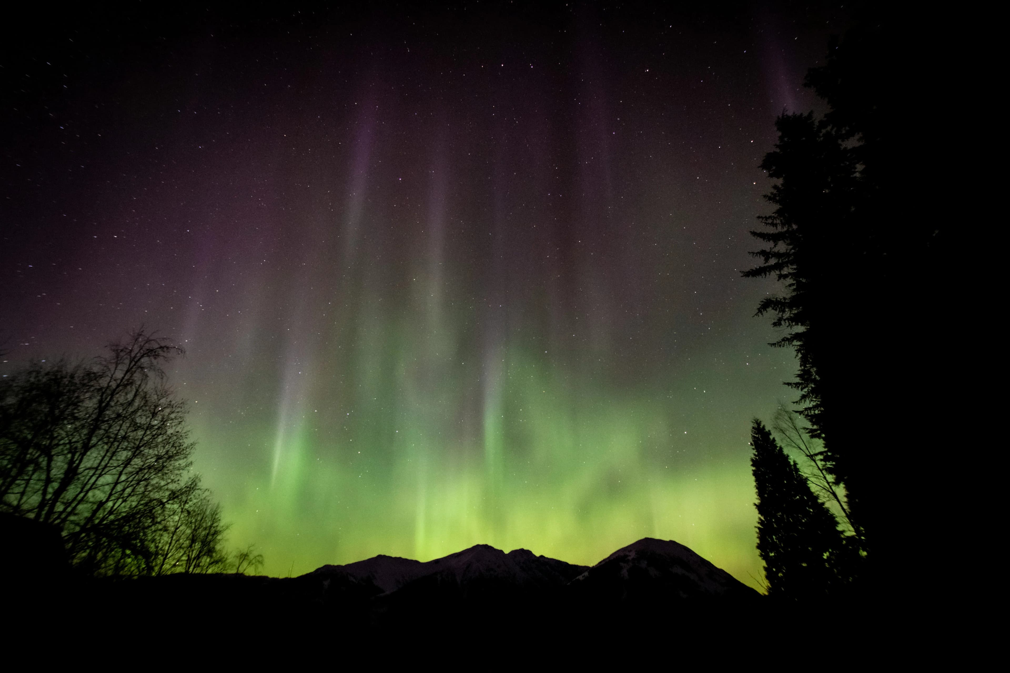
Sometimes — but rarely in a satisfying way. Very thin, high-altitude cirrus cloud (the wispy strands made of ice crystals, typically above 6,000 m) barely attenuates visible light. A bright KP 4–5 display might push through thin cirrus and remain visible, though with reduced brightness and no fine structure. The aurora might look like a diffuse green smear rather than defined curtains and rays.
Altostratus — the mid-level grey layer that makes days look uniformly dull — is borderline. On a very strong display (KP 6+), a faint green glow can sometimes be detected through altostratus, but it's unsatisfying. Stratocumulus and cumulus clouds (the fluffy lower-level clouds) block aurora completely. Nimbostratus (rain clouds) and dense overcast are total blockades.
The bottom line: assume clouds block aurora unless they're obviously thin, high, and sparse. Don't set out on a clear drive expecting to see something through a "partly cloudy" sky — you'll usually be disappointed.
Reading a Cloud Forecast for Aurora
Standard weather apps are unreliable for this purpose. They show cloud cover as a percentage but with coarse spatial and temporal resolution — they won't capture a 50 km gap in cloud that might be passing through your area at midnight. For aurora chasing, you need better tools.
- Satellite cloud imagery: Services like Sat24, EUMETSAT's viewer, and NASA Worldview show actual satellite images of current cloud cover, updated every 15 minutes. This is the gold standard — you're looking at real clouds, not a model prediction.
- Windy.com cloud layer: Windy offers a high-resolution cloud cover model that's better than standard weather apps. Check both the current time and the forecast for overnight hours. Look for the cloud base height too — low cloud is worse than high cloud.
- Clear Outside (UK-focused): Built for astronomers and aurora chasers, this app shows cloud cover, seeing conditions, and astronomical data in one view. Widely used across the UK and Scandinavia.
- MetNo (Norwegian Meteorological Institute): For Scandinavia specifically, yr.no (the public-facing site) provides detailed cloud forecasts with good spatial resolution and is free.
Cloud Patterns at Key Destinations
Where you're standing matters enormously. Tromsø, on the Norwegian coast, receives Atlantic weather systems that can blanket the area for days. Clear-night probability in winter is around 30–40%. Alta, 100 km inland, benefits from its inland position and averages closer to 40–50%. Abisko in Sweden, on the lee of the Scandinavian mountains, has its famous blue hole — clear-night probability is closer to 50–60% in winter, significantly better than coastal Norway.
Iceland's Reykjavik has the lowest clear-sky probability of the major aurora destinations — sometimes as low as 20–25% in December. The Westfjords and north Iceland around Akureyri have somewhat better statistics. Finland's Lapland sits between Norway's coast and Sweden's interior in cloud frequency.
Chasing Gaps: The Key Skill
Experienced aurora chasers don't wait for a completely clear forecast — they chase cloud gaps. A cloud system moving through a region typically leaves temporary clear windows as fronts pass. If you can identify where a clear window is heading, drive there.
This requires a car, flexibility, and a willingness to drive 100+ km at midnight. It sounds extreme until you've stood under a blazing KP 5 display that you found by following a clear patch across the map while everyone else was watching Netflix at the hotel. The guides who work in Tromsø and Alta do this every night — they're not driving to a scenic viewpoint, they're driving toward the satellite cloud image's clear patch.
Set a 3-hour check alarm when you go to bed on a marginal night. Check the satellite cloud image at 1 AM. If a gap has opened over your location, you have time to get out and see something before the next front arrives. Some of the best aurora nights are the ones nobody expected.
Why Winter Cloud Cover Matters More Than KP Variability
Here's a useful way to think about it. KP 3 produces aurora visible from inside the auroral oval on roughly 80% of nights during a solar maximum period. Cloud-free nights at Tromsø in winter occur roughly 35% of the time. The probability of a clear night with KP 3+ is therefore around 28% — not because aurora is rare, but because clear skies are.
This is why the advice to "book 5–7 nights" is universal among aurora guides. It's not because the aurora is unreliable. It's because the weather needs time to cooperate. Longer stays dramatically improve your odds of catching at least one perfect clear aurora night.
Frequently Asked Questions
Check the live Northern Lights forecast on PolarForecast — KP index, solar wind, cloud cover, and viewing probability updated in real time.
Check live forecast →